Emerald Triangle Loop 
Distance: 11.4 miles (loop)
Yoho National Park, near Yoho in The Canadian Rockies
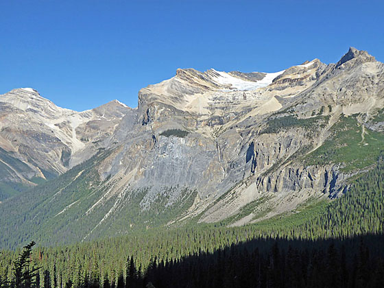
Stunning views of the President Range and the Emerald Lake Valley are the rewards of this interesting circuit. Along the way pass scenic Emerald Basin, travel through wildflower-filled meadows and visit Burgess Pass, with fine views of Lake O’Hara region’s high peaks.
See Trail Detail/Full Description
- Distance: 11.4 miles (loop)
- Elevation: 4,620-ft. at Trailhead
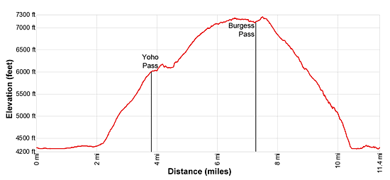
Maximum elevation: 7,250-ft. - Elevation Gain: 2,990-ft.
- Difficulty: strenuous
- More Hikes in:
Yoho / Field / The Canadian Rockies
Why Hike Emerald Triangle Loop
Fine views of the Emerald Lake Valley, the President Range and Wapata Mountain are the hallmarks of the great loop hike that encompasses three trails; Yoho Pass, the Wapta Highline and Burgess Pass. The hike initially travels through spruce, fir and red cedars along the western shores of Emerald Lake, passes Emerald Basin -- a natural amphitheater, and then ascends steeply to Yoho Pass. The climb is accompanies by great views of a waterfall plunging down the flanks of Mitchell Peak (8,843-ft). From forested Yoho Pass the trail ascends along the Wapta Highline, also known as the Burgess Highline, with spectacular views of the President Range and the Emerald Lake Valley. In season the hillsides along the trail are ablaze with wildflowers. Beyond Burgess Pass the trail drops steeply to the eastern shore of Emerald Lake and then travels back to the trailhead along the lake’s south shore.
This is a strenuous loop that requires a steep climb to Yoho Pass, a high traverse, with some exposure along the Wapata Highline and then a knee numbing descent on the Burgess trail to Emerald Lake.
Elevation Profile

Trail Resources
Trail Detail/Full Description / Trail Photo Gallery / Trail Map
Basecamp(s) Information:
Yoho / Field
Region Information:
The Canadian Rockies
Other Hiking Regions in:
Alberta / British Columbia
